Statistics Mozambique 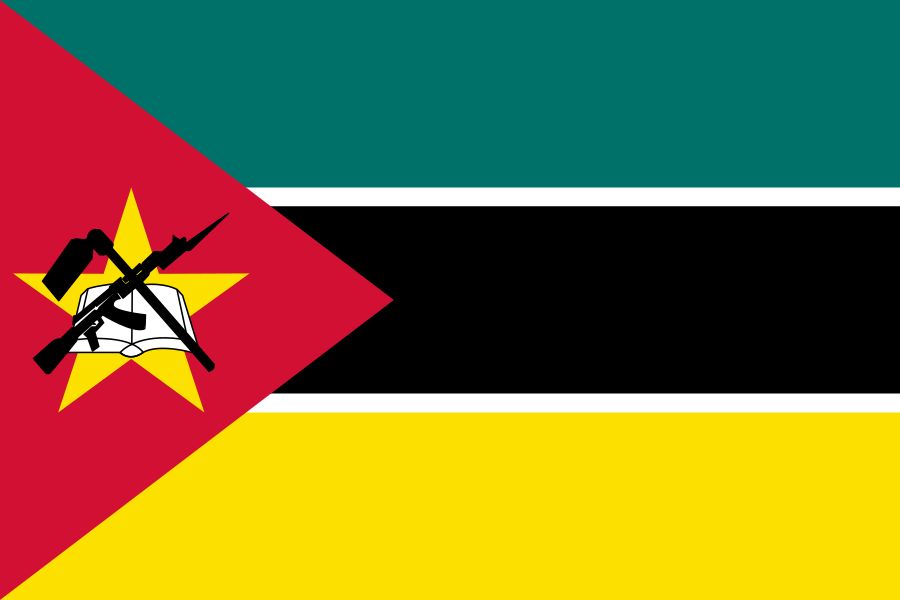

Mozambique in the World

Mozambique - Introduction 1989
top of pageBackground: Almost five centuries as a Portuguese colony came to a close with independence in 1975. Large-scale emigration by whites economic dependence on South Africa a severe drought and a prolonged civil war hindered the country's development. The ruling party formally abandoned Marxism in 1989.
Land boundaries:
4,571 km total
Malawi 1,569 km, South Africa 491 km, Swaziland 105 km, Tanzania 756 km, Zambia 419 km, Zimbabwe 1,231 km
Malawi 1,569 km, South Africa 491 km, Swaziland 105 km, Tanzania 756 km, Zambia 419 km, Zimbabwe 1,231 km
Land use: 4% arable land; NEGL% permanent crops; 56% meadows and pastures; 20% forest and woodland; 20% other; includes NEGL% irrigated
Mozambique - People 1989
top of pageEthnic groups: majority from indigenous tribal groups; about 10,000 Europeans, 35,000 Euro-Africans, 15,000 Indians
Environment
Current issues: severe drought and floods occur in south; desertification geoad0.gif" border="0" geoad1
Mozambique - Government 1989
top of pageAdministrative divisions: 10 provinces (provincias, singular - provincia; Cabo Delgado, Gaza, Inhambane, Manica, Maputo, Nampula, Niassa, Sofala, Tete, Zambezia
Executive branch: Chief of State - President Joaquim Alberto CHISSANO (since 6 November 1986; Head of Government - Prime Minister Mario da Graca MACHUNGO (since 17 July 1986)
Legislative branch: Mozambique Armed Forces (including Army, Border Guard, Naval Command, Air Force)
International organization participation: AfDB, CCC, FAO, G-77, GATT (de facto), IBRD, ICAO, IFAD, ILO, IMF, IMO, ITU, NAM, OAU, SADCC, UN, UNESCO, UPU, WHO, WMO
Diplomatic representation
In the us: Ambassador Valeriano FERRAO; Chancery at Suite 570, 1990 M Street NW, Washington DC 20,036; telephone (202) 293-7,146; US - Ambassador Melissa F. WELLS; Embassy at 3rd Floor, 35 Rua Da Mesquita, Maputo (mailing address is P. O. Box 783, Maputo; telephone 743,167 or 744,163
Flag description: three equal horizontal bands of green (top), black, and yellow with a red isosceles triangle based on the hoist side; the black band is edged in white; centered in the triangle is a yellow five-pointed star bearing a crossed rifle and hoe in black superimposed on an open white book
Mozambique - Economy 1989
top of pageEconomy overview: One of Africa's poorest countries, Mozambique has a per capita GDP of under $100. The nation has failed to exploit the economic potential of its large agricultural, hydropower, and transportation resources. Agriculture is the most important sector of the economy, accounting for nearly 50% of GDP and for a major share of exports. Industry contributes roughly 10% to GDP, depending heavily upon agricultural products for processing. Over the past decade the economy has experienced a dramatic deterioration. After growing at more than 2% annually during the period 1977-81, GDP declined at an annual rate of 8% between 1981 and 1986. Agricultural output is at only 75% of its 1981 level, and grain has to be imported. Problems persist, with industry operating at only 20-40% of capacity, and the economy is heavily dependent upon foreign assistance to stay afloat.
Agriculture products: cash crops - cotton, cashew nuts, sugar, tea, copra, sisal, rice; other crops - corn, wheat, peanuts, potatoes, beans, sorghum, cassava
Industries: food, beverages, chemicals (fertilizer, soap, paints), petroleum products, textiles, nonmetallic mineral products (cement, glass, asbestos), tobacco
Budget: revenues $122 million; expenditures $321 million, including capital expenditures of $64 million (1987 est.)
Exports: $85.9 million (f.o.b., 1987 est.)
Commodities: shrimp 48%, cashews 21%, sugar 10%, copra 3%, citrus 3%
Partners: US, Western Europe, GDR, Japan
Imports: $642 million (c.i.f., 1987 est.), including aid
Commodities: food, clothing, farm equipment, petroleum
Partners: US, Western Europe, USSR
Mozambique - Energy 1989
top of pageMozambique - Communication 1989
top of pageMozambique - Military 1989
top of pageMozambique - Transportation 1989
top of pageAirports: 214 total, 171 usable; 27 with permanent-surface runways; 6 with runways 2,440-3,659 m; 30 with runways 1,220-2,439 m
Mozambique - Transnational issues 1989
top of page
🅶🅷🅴🅾🆂.🅲🅾🅼