Statistical information Myanmar 2002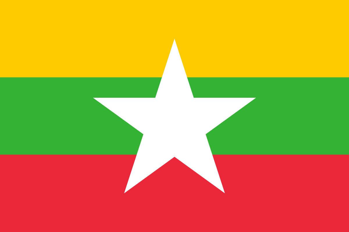

Myanmar in the World

Myanmar - Introduction 2002
top of pageBackground: Britain conquered Burma over a period of 62 years (1824-86) and incorporated it into its Indian Empire. Burma was administered as a province of India until 1937 when it became a separate self-governing colony; independence outside of the Commonwealth was attained in 1948. Gen. NE WIN dominated the government from 1962 to 1988 first as military ruler then as president and later as political kingmaker. Despite multiparty elections in 1990 that resulted in the main opposition party winning a decisive victory the ruling military junta refused to hand over power. Key opposition leader and Nobel Peace Prize recipient AUNG SAN SUU KYI under house arrest from 1989 to 1995 was again placed under house detention from September 2000 to May 2002; her supporters are routinely harassed or jailed.
Myanmar - Geography 2002
top of pageLocation: Southeastern Asia bordering the Andaman Sea and the Bay of Bengal between Bangladesh and Thailand
Geographic coordinates: 22 00 N 98 00 E
Map reference: Southeast Asia
Area
Total: 678,500 km²
Land: 657,740 km²
Water: 20,760 km²
Comparative: slightly smaller than Texas
Land boundaries
Total: 5,876 km
Border countries: (5) Bangladesh 193 km; , China 2,185 km; , India 1,463 km; , Laos 235 km; , Thailand 1,800 km
Coastline: 1930 km
Maritime claims
Contiguous zone: 24 NM
Territorial sea: 12 NM
Continental shelf: 200 NM or to the edge of the continental margin
Exclusive economic zone: 200 NM
Climate: tropical monsoon; cloudy rainy hot humid summers (southwest monsoon June to September); less cloudy scant rainfall mild temperatures lower humidity during winter (northeast monsoon December to April)
Terrain: central lowlands ringed by steep rugged highlands
Elevation
Extremes lowest point: Andaman Sea 0 m
Extremes highest point: Hkakabo Razi 5,881 m
Natural resources: petroleum timber tin antimony zinc copper tungsten lead coal some marble limestone precious stones natural gas hydropower
Land use
Land use
Arable land: 14.53%
Permanent crops: 0.9%
Other: 84.57% (1998 est.)
Irrigated land: 15,920 km² (1998 est.)
Major rivers
Major watersheds area km²
Total water withdrawal
Total renewable water resources
Natural hazards: destructive earthquakes and cyclones; flooding and landslides common during rainy season (June to September); periodic droughts
Geography
Note: strategic location near major Indian Ocean shipping lanes
Myanmar - People 2002
top of pagePopulation
Note: estimates for this country explicitly take into account the effects of excess mortality due to AIDS; this can result in lower life expectancy, higher infant mortality and death rates, lower population and growth rates, and changes in the distribution of population by age and sex than would otherwise be expected (July 2002 est.)
Growth rate: 0.56% (2002 est.)
Below poverty line: 25% (2000 est.)
Nationality
Noun: Burmese (singular and plural)
Adjective: Burmese
Ethnic groups: Burman 68% Shan 9% Karen 7% Rakhine 4% Chinese 3% Indian 2% Mon 2% other 5%
Languages: Burmese minority ethnic groups have their own languages
Religions: Buddhist 89% Christian 4% (Baptist 3% Roman Catholic 1%) Muslim 4% animist 1% other 2%
Demographic profile
Age structure
Age structure
0-14 years: 28.6% (male 6,158,039; female 5,905,314)
15-64 years: 66.6% (male 13,976,047; female 14,162,467)
65 years and over: 4.8% (male 905,476; female 1,130,881) (2002 est.)
Dependency ratios
Median age
Population growth rate: 0.56% (2002 est.)
Birth rate: 19.65 births/1000 population (2002 est.)
Death rate: 12.25 deaths/1000 population (2002 est.)
Net migration rate: -1.83 migrant(s)/1000 population (2002 est.)
Population distribution
Urbanization
Major urban areas
Environment
Current issues: deforestation; industrial pollution of air soil and water; inadequate sanitation and water treatment contribute to disease
International agreements party to: Biodiversity, Climate Change, Desertification, Endangered Species, Law of the Sea, Nuclear Test Ban, Ozone Layer Protection, Ship Pollution, Tropical Timber 83, Tropical Timber 94
International agreements signed but not ratified: none of the selected agreements
Air pollutants
Sex ratio
At birth: 1.06 male/female
Under 15 years: 1.04 male/female
15-64 years: 0.99 male/female
65 years and over: 0.8 male/female
Total population: 0.99 male/female (2002 est.)
Mothers mean age at first birth
Maternal mortality ratio
Infant mortality rate: 72.11 deaths/1000 live births (2002 est.)
Life expectancy at birth
Total population: 55.41 years
Female: 57.07 years (2002 est.)
Male: 53.85 years
Total fertility rate: 2.23 children born/woman (2002 est.)
Contraceptive prevalence rate
Drinking water source
Current health expenditure
Physicians density
Hospital bed density
Sanitation facility access
Hiv/Aids
Adult prevalence rate: 1.99% (1999 est.)
People living with hivaids: 530,000 (1999 est.)
Deaths: 48,000 (1999 est.)
Major infectious diseases
Obesity adult prevalence rate
Alcohol consumption
Tobacco use
Children under the age of 5 years underweight
Education expenditures
Literacy
Definition: age 15 and over can read and write
Total population: 83.1%
Male: 88.7%
Female: 77.7% (1995 est.)
Note: these are official statistics; estimates of functional literacy are likely closer to 30% (1999 est.)
School life expectancy primary to tertiary education
Youth unemployment
Myanmar - Government 2002
top of pageCountry name
Conventional long form: Union of Burma
Conventional short form: Burma
Local short form: Myanma Naingngandaw
Local long form: Pyidaungzu Myanma Naingngandaw (translated by the US Government as Union of Myanma and by the Burmese as Union of Myanmar)
Former: Socialist Republic of the Union of Burma
Note: since 1989 the military authorities in Burma have promoted the name Myanmar as a conventional name for their state; this decision was not approved by any sitting legislature in Burma, and the US Government did not adopt the name, which is a derivative of the Burmese short-form name Myanma Naingngandaw
Government type: military regime
Capital: Rangoon (regime refers to the capital as Yangon)
Administrative divisions: 7 divisions* (yin-mya singular - yin) and 7 states (pyine-mya singular - pyine); Chin State Ayeyarwady* Bago* Kachin State Kayin State Kayah State Magway* Mandalay* Mon State Rakhine State Sagaing* Shan State Tanintharyi* Yangon*
Dependent areas
Independence: 4 January 1948 (from UK)
National holiday: Independence Day 4 January (1948)
Constitution: 3 January 1974 (suspended since 18 September 1988); national convention started on 9 January 1993 to draft a new constitution; progress has since been stalled
Legal system: has not accepted compulsory ICJ jurisdiction
International law organization participation
Citizenship
Suffrage: 18 years of age; universal
Executive branch
Chief of state: Prime Minister and Chairman of the State Peace and Development Council Sr. Gen. THAN SHWE (since 23 April 1992); note - the prime minister is both the chief of state and head of government
Head of government: Prime Minister and Chairman of the State Peace and Development Council Sr. Gen. THAN SHWE (since 23 April 1992); note - the prime minister is both the chief of state and head of government
Cabinet: State Peace and Development Council (SPDC); military junta, so named 15 November 1997, which initially assumed power 18 September 1988 under the name State Law and Order Restoration Council; the SPDC oversees the cabinet
Elections: none; the prime minister assumed power upon resignation of the former prime minister
Legislative branch
Elections: last held 27 May 1990, but Assembly never convened
Election results: percent of vote by party - NA%; seats by party - NLD 392, SNLD 23, NUP 10, other 60
Judicial branch: remnants of the British-era legal system are in place but there is no guarantee of a fair public trial; the judiciary is not independent of the executive
Political parties and leaders: National League for Democracy or NLD [AUNG SHWE chairman AUNG SAN SUU KYI general secretary]; National Unity Party or NUP (proregime) [THA KYAW]; Shan Nationalities League for Democracy or SNLD [U KHUN TUN OO]; Union Solidarity and Development Association or USDA (proregime a social and political organization) [THAN AUNG general secretary]; and other smaller parties
International organization participation: ARF AsDB ASEAN CCC CP ESCAP FAO G-77 IAEA IBRD ICAO ICRM IDA IFAD IFC IFRCS ILO IMF IMO Interpol IOC ITU NAM OPCW (signatory) UN UNCTAD UNESCO UNIDO UPU WHO WIPO WMO WToO WTrO
Diplomatic representation
In the us chief of mission: Ambassador TIN WINN
In the us consulates general: New York
In the us fax: [1] (202) 332-9,046
In the us telephone: [1] (202) 332-9,044
In the us chancery: 2,300 S Street NW, Washington, DC 20,008
From the us chief of mission: Permanent Charge d'Affaires Carmen M. MARTINEZ
From the us embassy: 581 Merchant Street, Rangoon (GPO 521)
From the us mailing address: Box B, APO AP 96,546
From the us telephone: [95] (1) 256-019, 256-016
From the us fax: [95] (1) 256-018
Flag description: red with a blue rectangle in the upper hoist-side corner bearing all in white 14 five-pointed stars encircling a cogwheel containing a stalk of rice; the 14 stars represent the 14 administrative divisions
National symbols
National anthem
National heritage
Myanmar - Economy 2002
top of pageEconomy overview: Burma is a resource-rich country that suffers from abject rural poverty. The military regime took steps in the early 1990s to liberalize the economy after decades of failure under the 'Burmese Way to Socialism' but those efforts have since stalled. Burma has been unable to achieve monetary or fiscal stability resulting in an economy that suffers from serious macroeconomic imbalances - including an official exchange rate that overvalues the Burmese kyat by more than 100 times the market rate. In addition most overseas development assistance ceased after the junta suppressed the democracy movement in 1988 and subsequently ignored the results of the 1990 election. Burma is data poor and official statistics are often dated and inaccurate. Published estimates of Burma's foreign trade are greatly understated because of the size of the black market and border trade - often estimated to be one to two times the official economy.
Real gdp purchasing power parity
Real gdp growth rate: 2.3% (2001 est.)
Real gdp per capita: purchasing power parity - $1500 (2001 est.)
Gross national saving
Gdp composition by sector of origin
Gdp composition by end use
Gdp composition by sector of origin
Agriculture: 42%
Industry: 17%
Services: 41% (2000 est.)
Agriculture products: rice pulses beans sesame groundnuts sugarcane; hardwood; fish and fish products
Industries: agricultural processing; knit and woven apparel; wood and wood products; copper tin tungsten iron; construction materials; pharmaceuticals; fertilizer
Industrial production growth rate: NA%
Labor force: 23.7 million (1999 est.)
By occupation agriculture: 65%
By occupation industry: 10%
By occupation services: 25% (1999 est.)
Labor force
Unemployment rate: 5.1% (2001 est.)
Youth unemployment
Population below poverty line: 25% (2000 est.)
Gini index
Household income or consumption by percentage share
Lowest 10: 3%
Highest 10: 32% (1998)
Distribution of family income gini index
Budget
Revenues: $7.9 billion
Expenditures: $12.2 billion, including capital expenditures of $5.7 billion (FY96/97)
Taxes and other revenues
Public debt
Revenue
Fiscal year: 1 April - 31 March
Inflation rate consumer prices: 20% (2001 est.)
Central bank discount rate
Commercial bank prime lending rate
Stock of narrow money
Stock of broad money
Stock of domestic credit
Market value of publicly traded shares
Current account balance
Exports: $1.8 billion f.o.b. (2001)
Commodities: apparel 55% foodstuffs 18% wood products 13% precious stones 2% (2000)
Partners note: official trade statistics do not include trade in illicit goods - such as narcotics, teak, and gems - or the largely unrecorded border trade with China and Thailand
Imports: $2.2 billion f.o.b. (2001)
Commodities: machinery transport equipment construction materials food products textile fabrics petroleum products
Partners: China 26% Singapore 23% South Korea 15% Japan 10% Taiwan 10% (2000 est.)
Reserves of foreign exchange and gold
Debt external: $6 billion
Stock of direct foreign investment at home
Stock of direct foreign investment abroad
Exchange rates: kyats per US dollar - official rate - 6.8581 (January 2002) 6.7489 (2001) 6.5167 (2000) 6.2858 (1999) 6.3432 (1998) 6.2418 (1997); kyats per US dollar - black market exchange rate - 435 (yearend 2000)
Myanmar - Energy 2002
top of pageElectricity
Production: 4.766 billion kWh (2000)
Production by source fossil fuel: 83%
Production by source hydro: 17%
Production by source other: 0% (2000)
Production by source nuclear: 0%
Consumption: 4.432 billion kWh (2000)
Exports: 0 kWh (2000)
Imports: 0 kWh (2000)
Coal
Petroleum
Crude oil
Refined petroleum
Natural gas
Carbon dioxide emissions
Energy consumption per capita
Myanmar - Communication 2002
top of pageTelephones
Main lines in use: 250,000 (2000)
Mobile cellular: 8,492 (1997)
Telephone system
General assessment: meets minimum requirements for local and intercity service for business and government; international service is good
Domestic: NA
International: satellite earth station - 1 Intelsat (Indian Ocean)
Broadcast media
Internet
Country code: .mm
Service providers isps note: as of September 2000, Internet connections were legal only for the government, tourist offices, and a few large businesses (2000)
Users: 10,000 (2002)
Broadband fixed subscriptions
Myanmar - Military 2002
top of pageMilitary expenditures
Dollar figure: $39 million (FY97/98)
Percent of gdp: 2.1% (FY97/98)
Military and security forces
Military service age and obligation
Space program
Terrorist groups
Myanmar - Transportation 2002
top of pageNational air transport system
Civil aircraft registration country code prefix
Airports: 80 (2001)
With paved runways total: 8
With paved runways over 3047 m: 2
With paved runways 2438 to 3047 m: 2
With paved runways 914 to 1523 m: 1 (2002)
With paved runways 15-24 to 2437 m: 4
With unpaved runways total: 72
With unpaved runways under 914 m: 34 (2002)
With unpaved runways over 3047 m: 2
With unpaved runways 15-24 to 2437 m: 16
With unpaved runways 914 to 1523 m: 20
Heliports: 1 (2002)
Pipelines: crude oil 1343 km; natural gas 330 km
Railways
Total: 3,991 km
Narrow gauge: 3,991 km 1.000-m gauge (2000 est.)
Roadways
Waterways
Note: 3,200 km navigable by large commercial vessels
Merchant marine
Total: 35 ships (1,000 GRT or over) totaling 382,386 GRT/582,084 DWT
Note: includes some foreign-owned ships registered here as a flag of convenience: Germany 5, Japan 4 (2002 est.)
Ships by type: bulk 9, cargo 21, container 1, passenger/cargo 3, petroleum tanker 1
Ports and terminals
Myanmar - Transnational issues 2002
top of pageDisputes international: despite renewed border committee talks significant differences remain with Thailand over boundary alignment and the handling of ethnic guerrilla rebels refugees smuggling and drug trafficking in cross-border region; Burmese attempts to construct a dam on border stream with Bangladesh in 2001 prompted an armed response halting construction; Burmese Muslim migration into Bangladesh strains Bangladesh's meager resources
Refugees and internally displaced persons
Illicit drugs: world's second largest producer of illicit opium (potential production in 2002 - 630 metric tons down 27% due to drought and to a lesser extent eradication; cultivation in 2002 - 77,000 hectares a 27% decline from 2001); surrender of drug warlord KHUN SA's Mong Tai Army in January 1996 was hailed by Rangoon as a major counternarcotics success but lack of government will and ability to take on major narcotrafficking groups and lack of serious commitment against money laundering continues to hinder the overall antidrug effort; major source of methamphetamine and heroin for regional consumption
