Netherlands Antilles (part of the Kingdom of the Netherlands)
flag
map
Leeward IslandsWindward IslandsAtlantic OceanCaribbean SeaGulf of MexicoAnguillaAntigua and BarbudaThe BahamasBarbadosCubaDominicaDominican RepublicGrenadaHaitiJamaicaSaint Kitts and NevisSaint LuciaSaint Vincent and the GrenadinesTrinidad and TobagoArubaBritish Virgin IslandsCayman IslandsGuadeloupeMartiniqueMontserratNavassa islandPuerto RicoSaint-Martin (part of Guadeloupe overseas department of France)Turks and Caicos Islands (dependent territory of the U.K.)U.S. Virgin Islands (territory of the U.S.)ColombiaCosta RicaHondurasNicaraguaPanamaVenezuelaUnited States
 It is illegal to copy these maps - ©1995-2024 - all rights reserved 
Zoom: 1|2|3|4|5
View all places
pointer1
pointer2
message
zoommessage
zoomarea1
zoomarea2
zoomarea3
zoomarea4
zoomarea5
Map Styles: Political | Physical | Blank Map | Labeled Map | Reference
Netherlands Antilles: History | Money | Current Leaders | Symbols | Statistics | Travel Info | Weather
Related Topics: Central America | The Caribbean | The Netherlands
Distance: 
blank
 - ©1995-2024 - all rights reserved
contact | copyrights | privacy                   Gheos.com
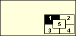
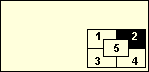
You found a piece of the puzzle

Please click here to complete it
');